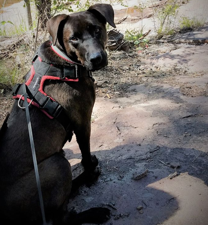
I try to get out twice a week to hike, sometimes thrice! Dog, Friend and I go back and back again to our favorite trails in the Gila National Forest: McMillan, Little Cherry Creek, Deadman’s Canyon, Signal Peak or to trailheads on the Continental Divide Trail that go through the Forest. When you hike the same trails throughout the years and seasons, you get to know individual trees, individual meadows that bloom with specific wildflowers at specific times in season, individual boulders and hoodoos. I have a favorite Grandmother Cottonwood on Little Cherry Creek trail that I stop and hug every time I pass. There are favorite hoodoos that I stop to admire each time I am on Cherry Creek Ranch Rd. On McMillan trail there’s a boulder-created shelter with a smoke-blackened “roof” about which I comment that it would provide a comfortable dry shelter in a sudden storm – every time I hike by it. A couple of old skeleton junipers along Deadman’s Canyon. A particular view of Cooke’s Peak and the Floridas from a section of the CDT.
Uprooted young pine on McMillan Trail
Uprooted young pine on McMillan Trail
Uprooted Ponderosa pine on Signal Peak
That may explain why I’ve been noticing all these downed trees. Some are laying roots-up. Some tops of trees are broken clean off trunks. Shattered limbs and branches litter the ground around trees bearing fresh wounds. If I wasn’t a regular visitor observing the environment around me, I probably would answer the question “Who notices?” with “Who, me?”
Snapped at the base — Ponderosa pine on McMillan Trail
Snapped Ponderosa pine on Signal Peak – one of many down
But I am noticing. There’s no dominant species among the victims. Well, maybe there’s a few more Ponderosa pines up in the higher elevations. Among the articles I’ve been reading, some research suggests that taller trees are more susceptible. Oh, but I’m getting ahead of myself on this rabbit trail of tree loss – the main and underlying cause of all this is drought. According to NOAA’s Drought.gov we here in southwest NM are in exceptional drought. That’s the most severe category. And it’s not short-term.
Drought may be an underlaying weakening, but there is the complicating impact of windstorms causing breakage. Our forest can be hit by strong down-drafts which are a sucker punch to already weakened tree structures. And then there’s the trifecta of long-term drought with incidental drenching with wind events. What can resist?
But back on the main trail. It’s disconcerting to walk a favorite trail and stop to exclaim to Friend or Dog or just to the Forest, “When did that oak fall?” or “Look at that uprooted youngster.” or “That pine snapped off halfway up the trunk!” And to know that I’m only seeing the edges of tree death. Match-sticks-pick-up-sticks throughout the Forest. If a tree falls in the forest, someone needs to be there to notice.
A grand old Arizona Sycamore on the Gila river suffered a broken trunk
I have my favorite hikes, each starting at a trailhead in the Gila National Forest. I mark multiple turn-around points on each trail, depending on my energy level and the anger of arthritis in my hips. A modest turn-around might be shy of one and half miles; on more energetic days, I might turn around at two-plus miles. Most of these trails are so familiar that I often don’t set my meter because I know just where I’ll turn back based on how far I want to hike.
The furthest endpoint of three of my favorite hikes is at a gate. I guess I never thought about going through those gates to see what lay beyond. Not that I’m not curious. But I remember the advice of a long-ago friend: “Hike until you’re half-tired.”
The first gate breeched was on the Continental Divide Trail (CDT) near my home. This is a section of the CDT I prefer when I’m hiking alone and want to just do a quick in-and-out. Dog needs her exercise and Sunday mornings are good opportunities to get her on this trail just long enough to work her nose, to wear off a little of that energy. Not long ago, my friend and I decided to hike this trail to the gate, just two miles from the trailhead. Good weather and good conversation, plus a good pace, and we got to the gate before my hips had a chance to complain. We decided to see what was on the other side. The CDT continued, of course; the gate simply marked the boundary of the rancher’s grazing lease. On we walked for another, oh, maybe half a mile and then the trail began a switch-back down into a deep arroyo. We turned back, but not before I took a picture of the view. This was one of those times when I kept thinking: just a little farther – just around that big juniper – just a little up that hill – and we’d get a great view of Bear Creek Canyon. That hike, having gone beyond the gate, added up to just about five miles.
From the CDT, looking toward Bear Creek Canyon and Tadpole Ridge
The next gate was at the end of the trail in Pancho Canyon, on the Gila River. Another favorite hike, Dog, Friend and I retreat to this trail in the heat of summer, always ending up with our feet in the river watching the idling birds. This section of trail is not much more than a mile one-way but it’s shady, rife with Common Black Hawks and warblers and perfect on an early morning before the temps hit the 90s. A couple of weeks ago, we headed out there in cooler weather to leaf-peep at the golden Cottonwoods and white-barked Arizona Sycamores.
Cottonwood – Pancho Canyon on the Gila River
Lower temps are conducive to longer walks so when we reached the gate at the far end of this stretch of river, we decided to keep going. I knew what was on the other side; I have driven up and over the ridge and down to the river, ending at Ira Canyon at the far end. I have never hiked from one end to the other. This seemed like the day to try. Once through the gate, we dropped down to the river on the only obvious trail – and came to a dead end. Retracing our steps, we found another spur through the weeds. That spur wandered through a small copse of Sycamore, Cottonwood and coyote willow, only to end at another point on the river. We stood listening to the water moving over the rocks in riffles while Dog hopped around chest-deep in the river. Filled with river-music, we turned back for that gate and Poncho Canyon.
A final gate marks the two-mile point on the CDT heading south from Gold Gulch Rd. This section of the CDT is not one for summer. The trail is exposed to both sun and breeze, traversing the sides of a ridge, dropping into two meadows and climbing out before finally relaxing through a forest of waist-high bear grass. On this clear cool morning, Dog, Friend and I decided that a sunny trail was just the thing. We hiked until we reached the gate and contemplated returning to the road where we were parked. But neither of us had been beyond this point and, having plenty of time and the best weather for hiking, we slipped the chain on the gate and went through, securing the gate behind us. We had rather anticipated we might connect with Rt 90 and the cross-over to C-Bar and the CDT on the east side of 90. Or at least see 90 in the near distance. Once up on a little hillock, we could see that Rt 90 was still a long distance to the southeast. After hiking about three-quarter mile through an unchanging landscape, we decided to head back. Back at Gold Gulch and the truck, we recorded almost five miles and one tuckered Dog.
Not all gates are made of metal. Not all gates demark grazing leases. Some are just there to mark the way and to bring a smile to the next to pass by.
West Fork, Gila River, Gila Wilderness — early morning
Dawn came softly. I had just closed my eyes to a deep sky full of stars, and now I opened to a sky just lightening. Carol’s and Allyson’s sleeping bags were not moving, suggesting that they were both still in the Land of Nod. Behind me, though, I could hear firewood being thrown onto the morning fire. Looking past my feet into the trees, six horses moved at a hobbled pace through the grass, heads down and cropping. They had been released from their ties and sent out to breakfast.
I resisted the urge to immediately go looking for coffee, instead rolling up my sleeping bag, folding my tarps, gathering my stuff into a coherent pile and taking my saddle pads over to where the saddles and tack were stacked. My saddle blanket went with me to fireside to provide my seat cushion on the log.
Other than a bright good-morning, Corbin and Joe continued getting ready for our day: building up the fire, filling the coffee pot and the cook pot with water and setting them on the coals to boil, cutting fruit for our breakfast of oatmeal. Corbin had made a comment the evening before that there’s something therapeutic about sitting and staring into a campfire. I practiced a little pre-prandial therapy, since there was little I could do to help the preparations. Eventually, we were all gathered, coffee mugs and oatmeal in hand and the day properly begun.
As we sat and compared nighttime noise stories – I had heard a Great Horned Owl and wondered if anyone else did – occasionally either Joe or Corbin would count to six. If they only counted to five, Corbin would go in search of the missing horse. This was something I had observed previously while in camp. Even though hobbled around the front feet, a horse can make quite a bit of headway, often ranging out of sight. He would encourage them back, usually with little trouble. His horse, Biscuit, had an investigative nose. She was often poking around the food stores, poking at Corbin’s bedroll, or at anything else she found interesting. Poor Smoke, on the other hand, had little patience for her hobbles. This morning, as she tried to move forward, she stumbled over her front feet, sat back on her haunches, and stood in a quiver. Joe looked at her and just shook his head. When I curried and cajoled her later, I noticed that she had a little scrape on each front foot, just above the hoof.
Well fed, once again, and it was time to pack up for our last day. As we were ready to leave the fire, Corbin – or was it Joe? – told us that not long after we left the camp, we would come to a part of the trail that runs along on the side of a steep hill for about 1/4 mile. Looking right at me, he said, “But Smoke is an old pro at this.” Well, yes, maybe she is. But I surely am not.
Oy vey. And here I thought the rest of our ride would be a stroll along the river, with the terror of yesterday’s Hells Hole put behind us. Well, as an old country song goes, “If you got your confidence with you, you can do anything.” We saddled up, mounted up, and headed out on our last 10+/-miles, including that 1/4 mile of hillside. I started working on my confidence right away.
Sure enough, it wasn’t long before the trail trended upward along the side of a partially wooded-partially rocky slope. It wasn’t steep enough to switchback and we weren’t climbing to the top. Rather the trail continued laterally. However, the challenge became obvious quickly. Most of the hillside was composed of talus slumped down from the top. Here was a difficulty for the horses that they didn’t have to navigate coming down Hells Hole trail. The trail was etched in across loose rock that clinked and slipped under their feet as they minced their way along. And then there was about 8 feet of slickrock slanted downhill to cross.
I engaged in both an out-loud and an under-breath conversation getting across that quarter-mile. “Watch your feet, girl. Ok, Smoke, be careful. You can do this.” Alternating with, under my breath: “f**kohf**kohsh*tTrust Your Horseahsh*tTrust Your Horseahf**k.” “Good Smoke, watch your feet, girl. Take it easy, Smoke.” Well, she did and Joe, who’d been leading on Jet, with Kissee tethered to him, was waiting on the now-wooded and pine-needled gentling slope to give me a thumbs-up. I grinned and announced the obvious, “I made it, white knuckles and all.” Allyson, riding behind me, had heard my overt exhortations to Smoke, but fortunately not my self-talk.
The West Fork Gorge is stunning. The walls are crenelated and hoodoo-ed. The river slips between the walls, sometimes pushing the trail up against the foot of the cliffs, sometimes forcing the trail up and over little ridges. A lot of rock on the river edges and in the river bed, rock of not insignificant size. Some of the riversides are a drop from a level trail, down a rocky slope and up on the far side. Smoke picked her way carefully down the rock, stepping between rocks in crossing the river and jostling up the far slope. Occasionally, her foot would step into a hole, pitching us forward. I did a lot of standing in my stirrups – stand-and-lean-back going down and stand-and-lean-forward to get up the other side. I peeked at the walls and spires of the gorge as much as I could. We stopped at several river crossings to water the horses and took advantage of those moments to pull out cameras and make record of the beauty and drama. This was part of the magic I didn’t want to miss.
Corbin on the trail along the river in the West Fork gorgeCarol takes a picture while Raider eyes another snack.Last lunch before leaving the Wilderness
Eventually we encountered people. And dogs. And noise. Backpackers setting up camp under a rock overhang. Hikers with two loose dogs; they held the dogs as we walked by. More hikers, casual as they stepped off-trail. Just as we were plunged into the vibrant fall colors and through the flood plain covered with Chamisa as we left the Gila Cliff area, we rode back into that environment after crossing the boundary out of the Wilderness.
Leaving the West Fork gorge and into the Gila River flood plain.
Coming into Woodys Corral, we were met by Joe’s support team with their trucks and trailers. I got my last dismount assist, took Smoke to a rail and tied her up. I unloaded my personal gear and put it in Carol’s car. Then, I unbridled Smoke and with Corbin’s help, pulled off the saddle, the saddle pads and blanket, saddle bags, rope and all the accoutrements of the trail and took everything to Joe’s truck. Time to say goodbye to Smoke. I rubbed her muzzle and scratched her forehead and down between her eyes. I reached under her chin and gave her head a hug. Another muzzle rub and another attempt at a head-hug. I guess Smoke isn’t a hugger; she tossed her head up and away from my attention. So, ok, I get it. Well, bye, Smoke. And thanks.
Here are two pictures, taken a very short distance apart on a trail along the Gila River. Which belongs? Which does not?
Fair warning: I am going to rant a bit. Live up to that tag line I believe in: A Public Lands Advocate.
I have been hiking and camping our National Forests, National Parks and National Monuments for the last several years. In fact, that’s what motivated me to start sharing my stories and photographs. Mostly, my stories are about my personal experiences, my photographs share my awe and wonder. Occasionally I lapse into “trainer” mode. I try to avoid “preacher” mode. Today, I’m all of those: storyteller, trainer, preacher.
I am wedded to the Gila National Forest, including the Gila River because that is my door-step. I have found my solace and soul here during these last difficult months when we are socially distant from our friends and family, not traveling, zoom-stuck and zoom-weary. If you’ve read any of my stories this year, you have traveled these trails with me, my dog and a friend or two.
It seems we are not the only ones moving into the Forest and along the River. Folks are coming from neighboring states and from farther away. Sadly, many who are finding their way this way are not here for the quiet and solitude that a Wild and Scenic River or a Wilderness experience can offer. They come, rather, in clusters and groups and occasionally, hordes. And it’s not so much that folks are coming. These wildlands and waterways are, after all, open to all of us; we all own these public lands. It is what folks are leaving behind when they go. Here are the most recent pictures I’ve taken of the trash that they’ve left. Trash that includes human waste (I blurred one part of one picture that was explicit).
And here are some excerpts from recent news coverage in our local paper of what others who, like me, are passionate about our wildlands, have found—and removed.
She pointed specifically to trash littering the sides of forest roads, recreation areas, and stretches of the Gila River. [She] invited the Daily Press to visit the Mogollon Box Day-Use Area last Friday, where about 150 to 200 people were posted up in a variety of groups, both large and small — but nearly none below the state-mandated size of five or fewer.
…half of the 20 people we spoke to were from elsewhere. Ohio, California, Arizona and Texas were a few of the states folks visiting the Gila last Friday called home.
…10 pounds of trash that [she] picked up during a 30-minute walk… Toilet paper and unburied human feces were seemingly everywhere on the riverbank, just yards from two sets of bathrooms maintained by the Forest Service.
Besides the obvious problems of trash and waste ruining the aesthetics of the outdoors, and noise pollution disrupting the peace that at least some visitors are seeking, there’s the issue of wild creatures getting used to trash as a food source.
What happens when people leave garbage…is that skunks, bears and other critters habituate to it. Having those animals getting used to being around people — that’s cute to some degree, but only until there’s a bear jumping on someone’s car. Silver City DailyPress, 6/15/20
If you are escaping to the Gila National Forest. Or to any Forest. Or Park. Or Monument. Or Bureau of Land Management wildland, here are the guidelines for Leave No Trace.
7 Leave No Trace principles to minimize impact:
Plan ahead and prepare
Travel and camp on durable surfaces [Note—Respect USFS signs for no motorized vehicles, including ATV, UTV and dirt-bikes.]
Minimize campfire impacts [Note–open fires are currently forbidden in the Gila National Forest]
Leave what you find
Be respectful of other visitors
Dispose of waste properly
Respect wildlife
Please be a Public Lands Advocate. The animals depend on you. The rivers depend on you. The forests depend on you. I depend on you.
Summertime in southwestern NM in times of social distancing, closures and forest fires. Challenges about where to hike. Criteria include an amenable temperature, amenable air quality and amenable solitude.
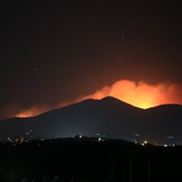
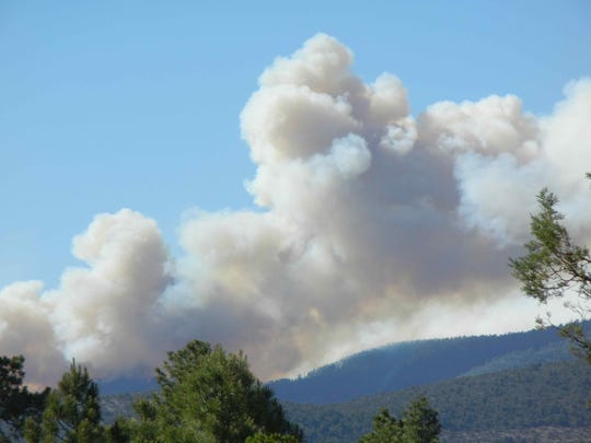
Summer temps typically lead me higher into the Gila National Forest where trails can be 10 to 20° cooler at 7,000’+ than in town, at 6,000’. However, since lightning strikes on June 6, there is a 6,000 (and growing) acre wildfire 12 miles from town that has caused the closure of the main road into the forest from here. Tailheads are all inaccessible, and some favorite trails are engulfed as the Tadpole Fire smolders and flames along the ridge and runs up Rt 15 to Signal Peak and Meadow Creek forest roads. We worry for our firefighters – notice how easy it is to take possession of what we value – out there fighting a so-far uncontained wildfire in the time of a coronavirus pandemic.
credit USFS Gila National Forest
Smoke becomes a fact of daily life and a factor in where to hike. If I can’t head “up the hill” into the forest, I’ll head west to the Gila River for a walk IN the river, the river now being much reduced and more compatible to wading.
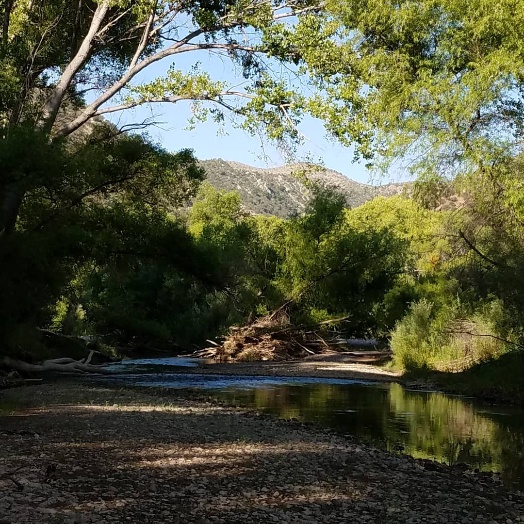
On Wednesday, my friend, Dog and I head to a campground on the Gila which provides easy access into the river for a cooling walk. We comment as we drive west that the smoke that had been so oppressive in town has lessened this morning. Then we begin to notice that the air is thickening the further away we get from the Tadpole Fire and the closer we get to our destination. At some point, the Mogollons disappear in the smoke and we begin to wonder where all this smoke is blowing in from. We arrive at the crest of the road down into the river-side campground only to see smoke blanketing the cottonwoods, the river itself now invisible. This is not what we anticipated nor where we want to exercise our lungs.
We decide to go back to the Gila Bird Area, the stretch of river we hiked along yesterday. We can dip our feet in the river there and wander along the shallows and wade the riffles. Back down the road, with Dog in the backseat getting a bit antsy. We turn down the track that leads to the giant sycamore that shelters the trailhead and river at Pancho Canyon. Round the last little bend to encounter a virtual tent city. Where the hell did all these people come from; they weren’t here yesterday! Six, maybe seven tents all crowded under the sycamore arms, facing each other as though creating a thoroughfare. Ice chests, camp chairs, other miscellany scattered around tents and a couple of children wandering along the “street.” While it’s not my thought to deny others the enjoyment of “my” (there’s that possessive again) Gila River, this is unexpected. Because so many official campgrounds are closed and because NM is surrounded by states that have taken no health precautions against Covid-19 and thus have soaring rates of infections, we are seeing campers in tents and rv’s and vans with out-of-state license plates pitched up in dispersed camping areas in the forest. No problem. Except when folks congregate where there is no bathroom, no water and no trash containment. Where are they going to poop? Behind a tree, in the weeds, among the rocks – and then leave it and the paper they used. Ugh and disgusting. One would think…but then most people don’t.
Needless to say, we leave only the dust of our quick departure, head back out to Rt 180 and now try to figure out just where the heck to go.
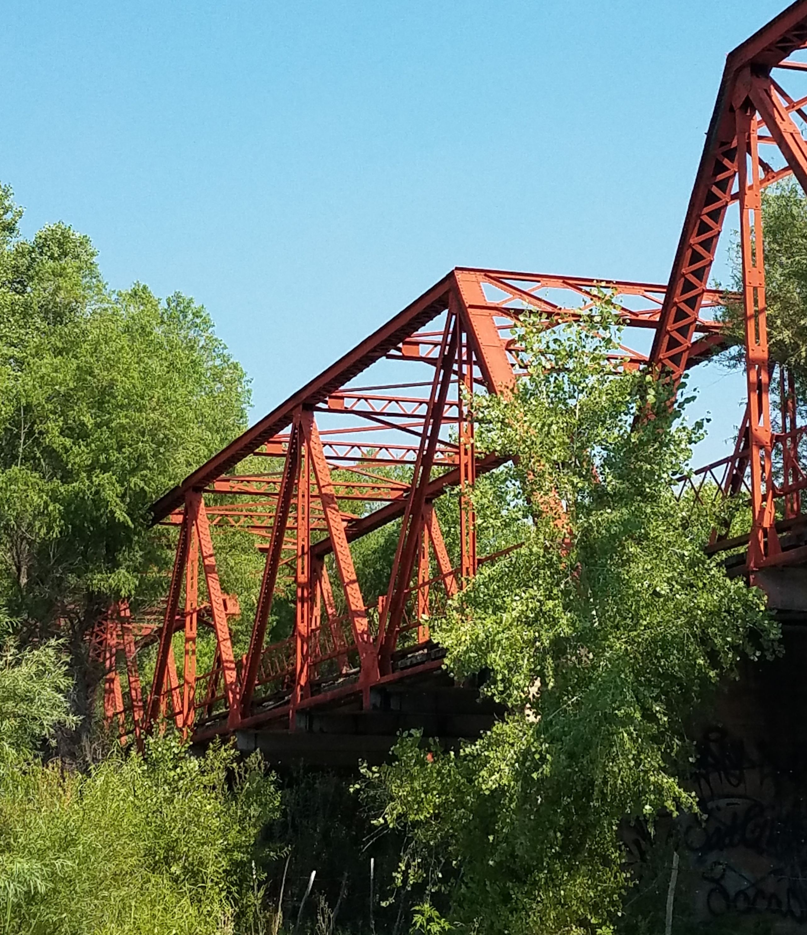
The Iron Bridge! We joke that we can see my truck tracks coming and going as we once again backtrack west. Fortunately the Iron Bridge is just down the road a couple of miles and we find the parking area deserted!
The Iron Bridge is on the old Rt 180, now in disuse except for swallows and hikers. It’s a beautiful old structure. The Gila runs under the bridge, along private ranch land and through property now owned by The Nature Conservancy. No official trails, but paths that are trod enough to keep the weeds down. It is getting warm, though and we are pretty exposed. We encounter a young man coming toward us as we stand uncertain, trying to discern where through the weeds we are meant to go. We head down the parting in the weeds that he just left.
We reach a cluster of trees and find a small citizens science project underway. A teacher and kids from Aldo Leopold High School have set up a bird-banding station. They have caught birds in mist nets and “bagged” the birds, one each in little bags hung from the branches of the tree. When we arrive, they are just in the process of banding four sibling Yellow Warblers, recently fledged. We stop and watch, and get a brief lesson in tagging each of these little guys with US Fish & Wildlife numbered tags. These small birds don’t ruffle very much as they are held, weighed, banded and finally, taken back into the cluster of trees where they were netted to be released.
Encountering this group of young scientists-to-be and environmentalists-in-fact is a treat and a pleasure. A reassurance that our world hasn’t entirely gone up in smoke, pestilence and overcrowding.
I got to Pancho Canyon thrice in a week, twice w Dog and once without her; all three times with one or two friends. Twice I spent my time looking mostly down and once, mostly up.
Pancho Canyon is on the Gila River at one end of the Gila Important Bird Area (IBA). How it got the name Pancho I haven’t a clue. Nevertheless, Pancho Canyon it is, for birding, tracking, and fishing if you’re looking to catch something wilder than you’ll hook in nearby Bill Evans stocked lake.
The river is lined with ancient cottonwoods and Arizona Sycamore. The sycamore are living sculptures of white-barked branches that arc and arch, intertwine and soar. They must be seen without leaves in order to truly appreciate their magnificent structure.
The cottonwoods earn their name this time of year, filling the air with threads and clumps of white fluff. Cottonwood snow covers everything: rock walls, trails and parking area, and any tree or bush within their snow-shed.
This couple of months are a birder’s heaven along the river. Standing on the river bank, I watched Cedar Waxwings hawking insects over the river. They dashed out from the overhanging branches, darting in C shapes from branch end, out and back to branch end. Four or five of these beautiful birds congregated in one tree-top, hawking in concert. That same flock was in the same territory – the same treetops – every day that I visited.
Red, yellow, rust, black, gray flashed through the understory and canopy. Birds moved so quickly that it was tough to find them still long enough to identify them. Colors helped. That robin-sized red bird was a Summer Tanager. The littler red bird with a quip of black was Vermillion Flycatcher. Waitwait, yellow and red shining in the sunlight across the river – that had to be a Western Tanager. Willow Flycatchers were not eye candy, but their “fitz-pew” was clear from the mid-story. Willow Flycatchers are one of two species that may help us protect the Gila River from diversion – they and Yellow-Billed Cuckoos are locally familiar but officially endangered. Way up at the top of a cottonwood was a shy Yellow Warbler, recognized by the rust streaks down its breast. Violet-green swallows swarmed around a sycamore where we parked, landing at the ends of trunks where branches had broken off, leaving hollow spaces now filled with nestlings anxious to be fed. These were about one-quarter of the birds active along the river and trail alongside. The rest were songs and chips in the trees above us, hidden in the new green leaves.
Overhead, soaring, one of three Common Blackhawks we saw. These large black hawks with a white stripe across their tails are common now, though at one time, I think they may have been less frequent residents. There are numerous pairs nesting along the river, here and further down-stream.
And all this on just one morning.
The other two mornings, we focused on the ground, doing some “dirt work” for our tracking class. The river was recently above its banks and upon receding, left layers of silt and mud, just perfect substrate for tracking. Especially little critters. And critters there were. Most were going incognito, as far as our identification skills stand at this point in time. However, we did get to see tracks being laid down even as we watched. Now, the pictures in our online course make a lot more sense.
caterpillar leaving tracks in sand
beetle at the top of the pic leaving tracks in the silt
A brief story of Dog: She loves to wade into river and streams. Belly deep is just right for lapping up water, snuffling under the surface or watching that leaf or this water-skeeter. Somehow, she must have missed her swimming lessons as a pup. At the edge of the river, she was tentatively edging her way along the visible bottom toward the point where the bottom dropped away into the river’s flow. Uncertain, she stretched out her right front leg, paw extended and spread, above water but obviously an attempt to anticipate bottom. Imagine that you are reaching your arm to its full length and spreading your fingers reaching for something unseen. It did not help Dog for me to remind her that she is one-half Labrador Retriever and that webbing between her toes is meant for swimming. Nope. She wasn’t going under. Not getting her head wet. Not today. Backing up, she glanced up at me and scrambled up out of the water to give a solid not-me-not-today shake off water.
Social distancing requires us to stay at least six feet from each other. Six feet? That is awfully close! Thus goes one of several New Mexico versions of this bit of coronavirus humor.
Another bit. Six feet is about the equivalent of: 6 Rio Grande Cutthroat Trout (or Gila Trout if you’re in my neighborhood); 2 mule deer bucks; 4 Roadrunners; or 2 Black Bears. This from NM Game and Fish recommendations for social distancing in the field. Of course, I’d rather be more than 2 black-bear lengths from any black bear, but that’s just me!
Down here in New Mexico, six feet of separation isn’t a problem for a large state, home to only about 2 million people, most of whom live in one of three cities. Practicing social distancing can be as easy as getting out onto some little corner of our millions of acres of public land.
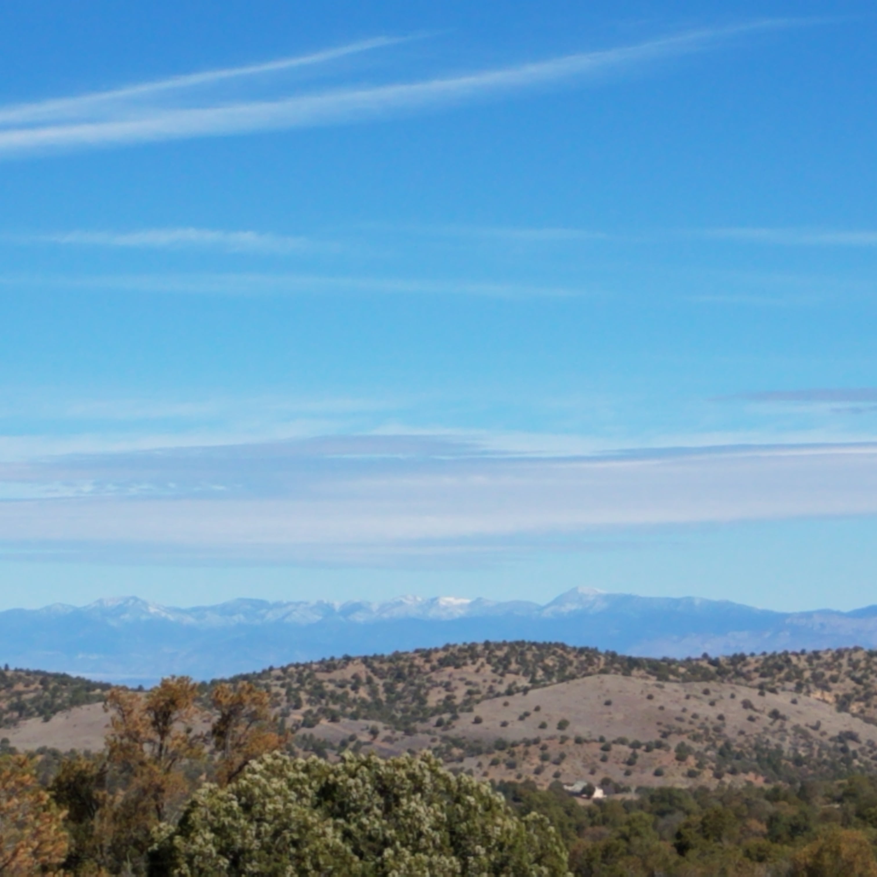
In 30 minutes or less, I can be on a trail in the Gila National Forest, hiking with my dog alone or with one, maybe two friends. We have the choice of going low: the Continental Divide Trail (CDT) starts down south in a desert environment at 6,000’ or less, wandering through pinion, juniper and boulders, as though through a carefully landscaped rock garden. Seen from the ridges, Big Hatchet and the Floridas stand stark against the border; Soldiers Return holds the near frame. The snaggletooth of Cookes Peak anchors the east. The Peloncios, Chiricahuas and Mt Graham bound the south and west. These days, Mt Graham and the tallest points of stone in the Chiricahuas are snow-topped.
Or I can go high, above 7,000’: Signal Peak, Cherry Creek trail, the trail out of McMillan Campground, Meadow Creek trail are all favorites when Ponderosa and fir are preferred, and a shady path calls. This time of year, the Redstarts and Red-faced Warblers are moving in and singing their territory.
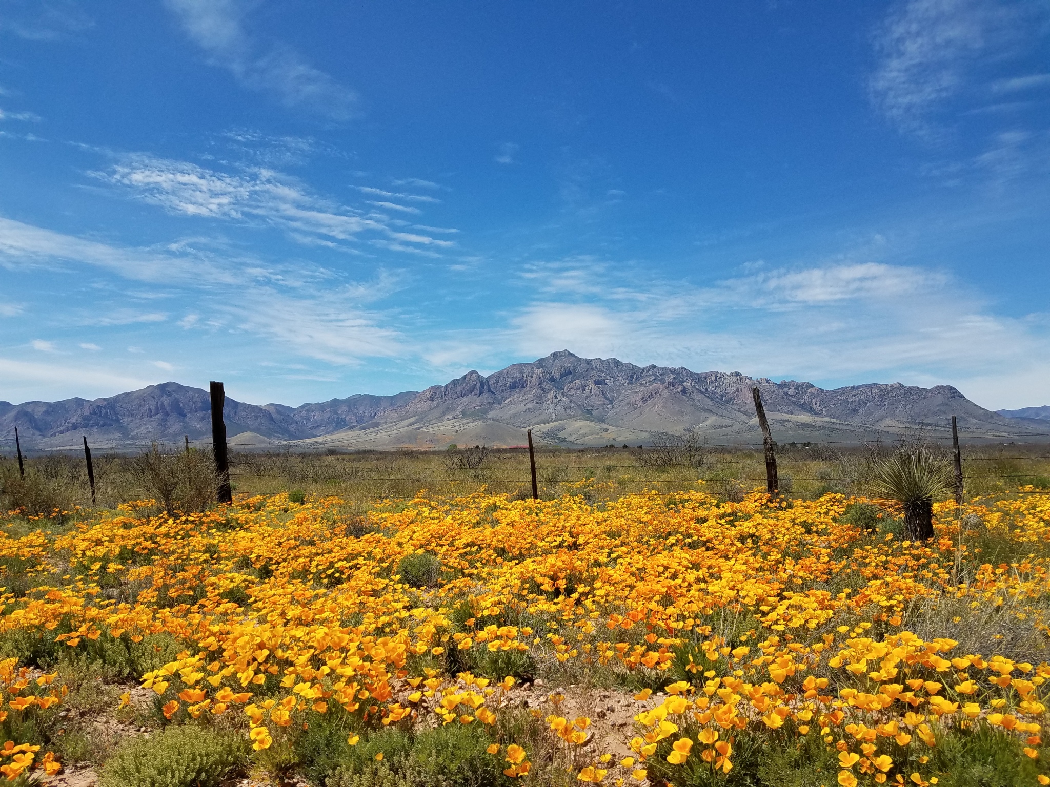
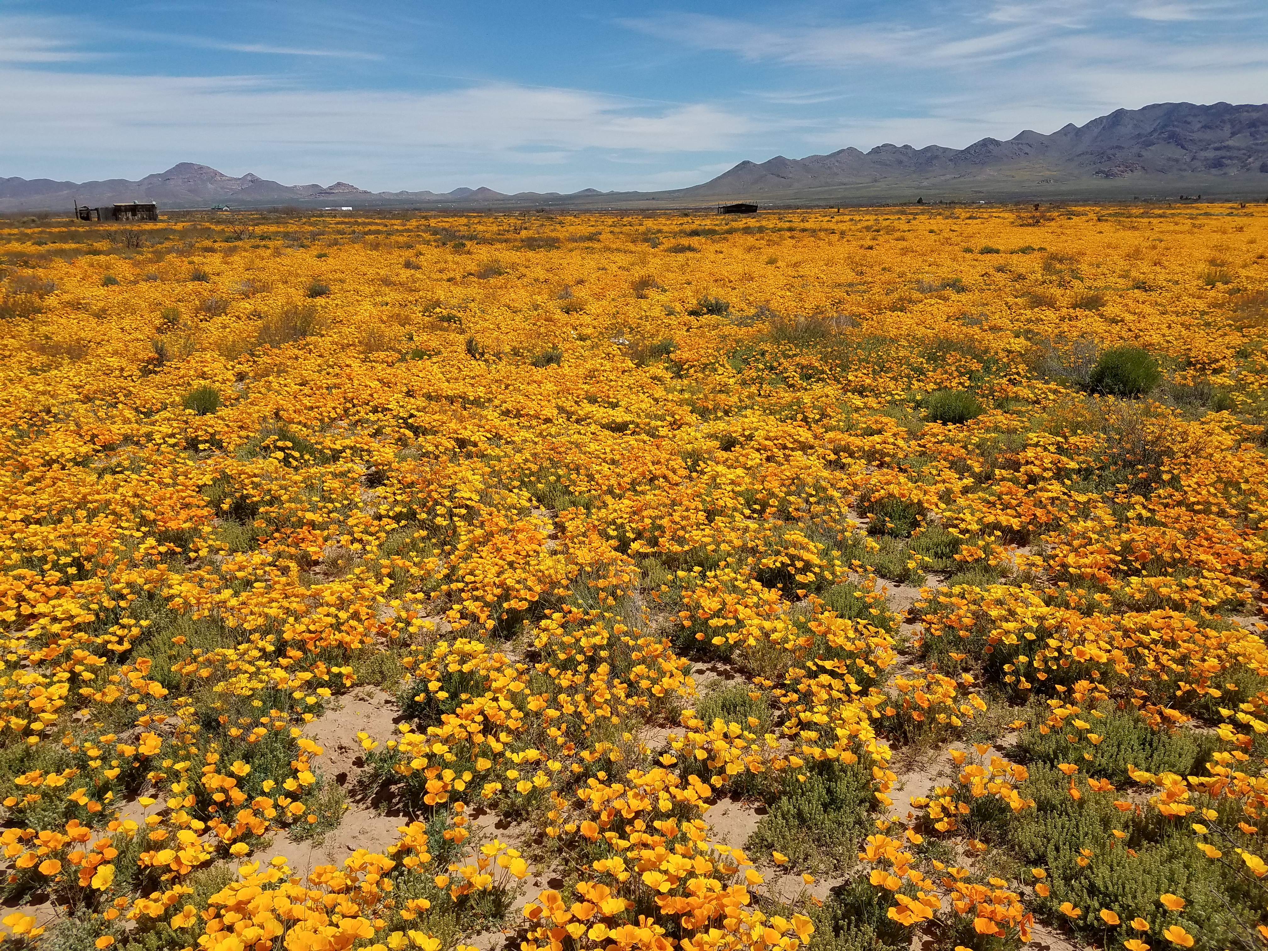
We’ve had a wet late winter and early spring. Rains have come with regularity. The soft female rains – or farmer rains, depending on your argot – soaked into the land at just the right time and right temperature and the result is a golden explosion.
Poppies. Mexican Poppies glowing along the roadside, in painterly splashes on the hillsides. And most spectacularly, spread across fields as quilts made of yellow, orange and gold, with love-knots of white. In New England, they go leaf-peeping in the fall. This week, I have indulged in Poppy-peeping.
Poppies don’t bloom alone. There are lupines, brittlebush, bladderpod, mustard and other yellow ground flowers whose names refuse to stick with me. There’s a spot along AZ Rt 191 where for about 3 miles, the hillsides look as though Monet was trying to improve on his Garden at Giverny.
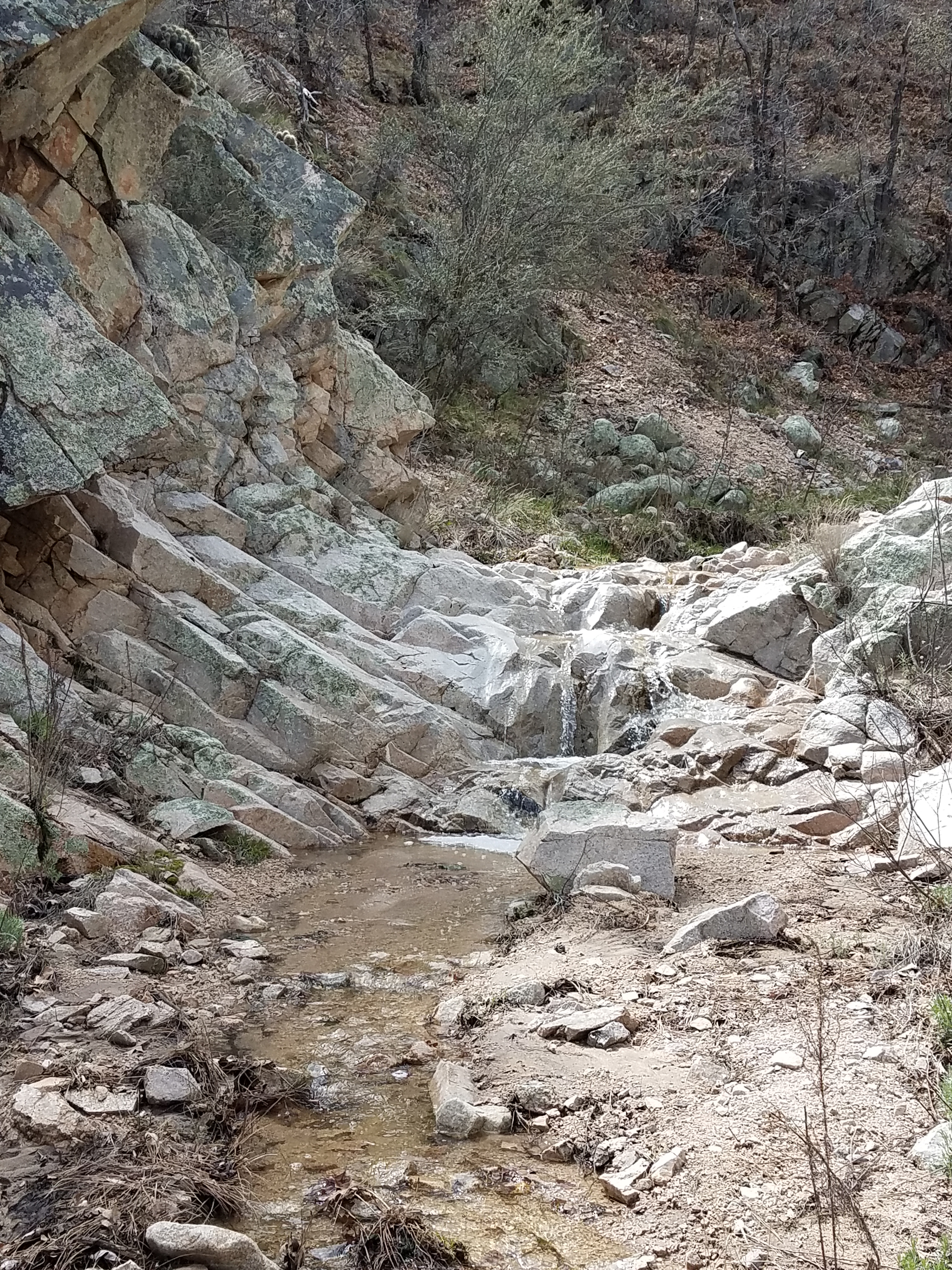
And, the other evidence of generous rains and snow-covered elevations is water.
Water running in the most ephemeral of streams, bubbling down stony creek beds that rarely entertain a flow outside of a good monsoon. Seeps become creeks, creeks become challenging crossings and waterfalls sing over rock.
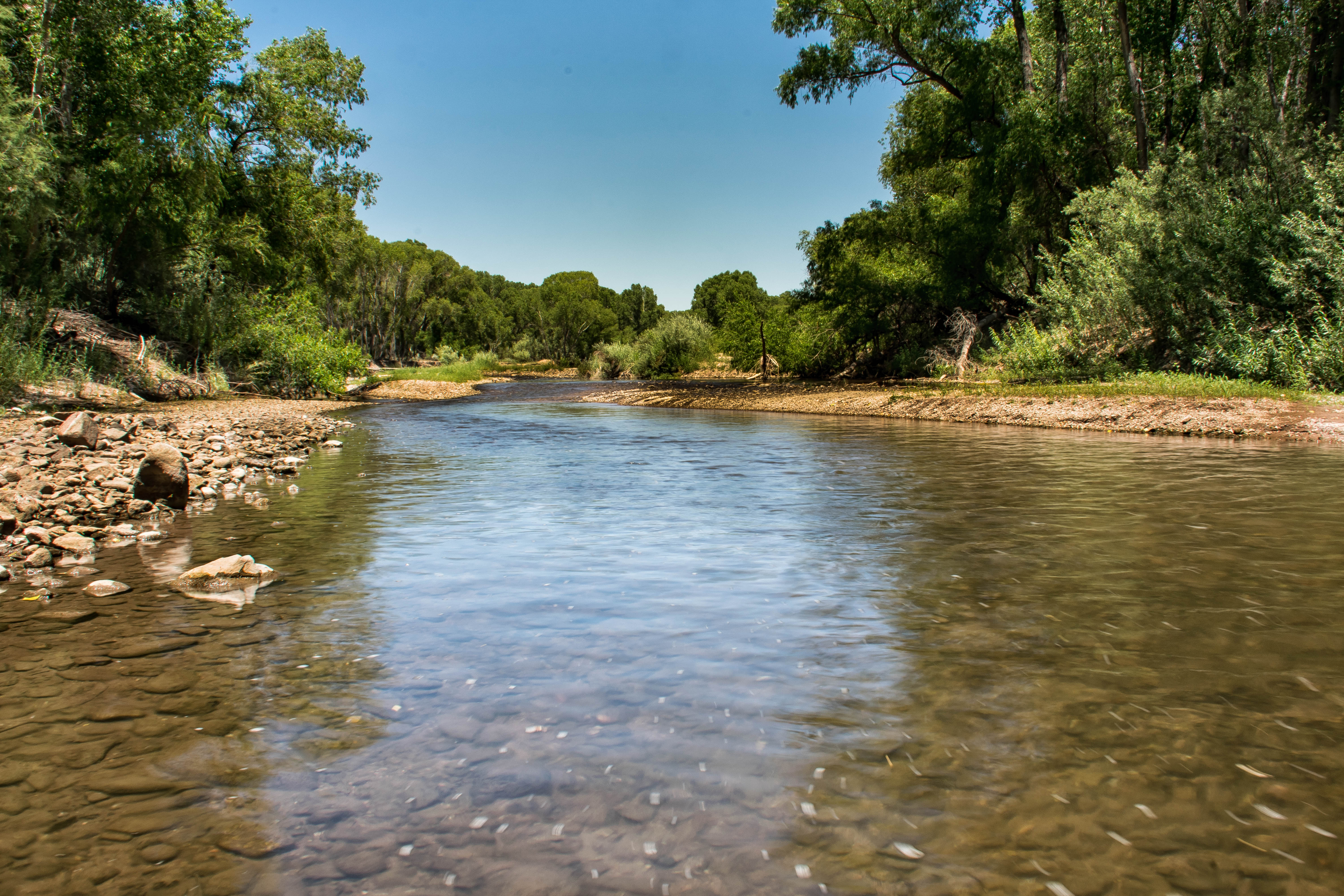
The Gila River gorges on the melt and silt from the snows on the Mogollons, spreading beyond its banks and filling the acequias.
The happening-together of a glorious wildflower bloom set against the backdrop of snowy peaks, and water courses that live up to their names has made for a rapturous spring of hikes and drives, indulging in color and sound, and following Dog’s nose up the trails. I hope and pray for the recovering health of my community, nation and the world.
Here, though, is my refuge. Social distancing at six feet? That’s awfully close!
On Friday morning, three of us plus dog went to the Gila River Important Bird Area (IBA) which is part of the Gila National Forest and about 30 miles from home. We are barely-better-than-beginning trackers, and we need more practice identifying the evidence our 4-legged neighbors leave behind.
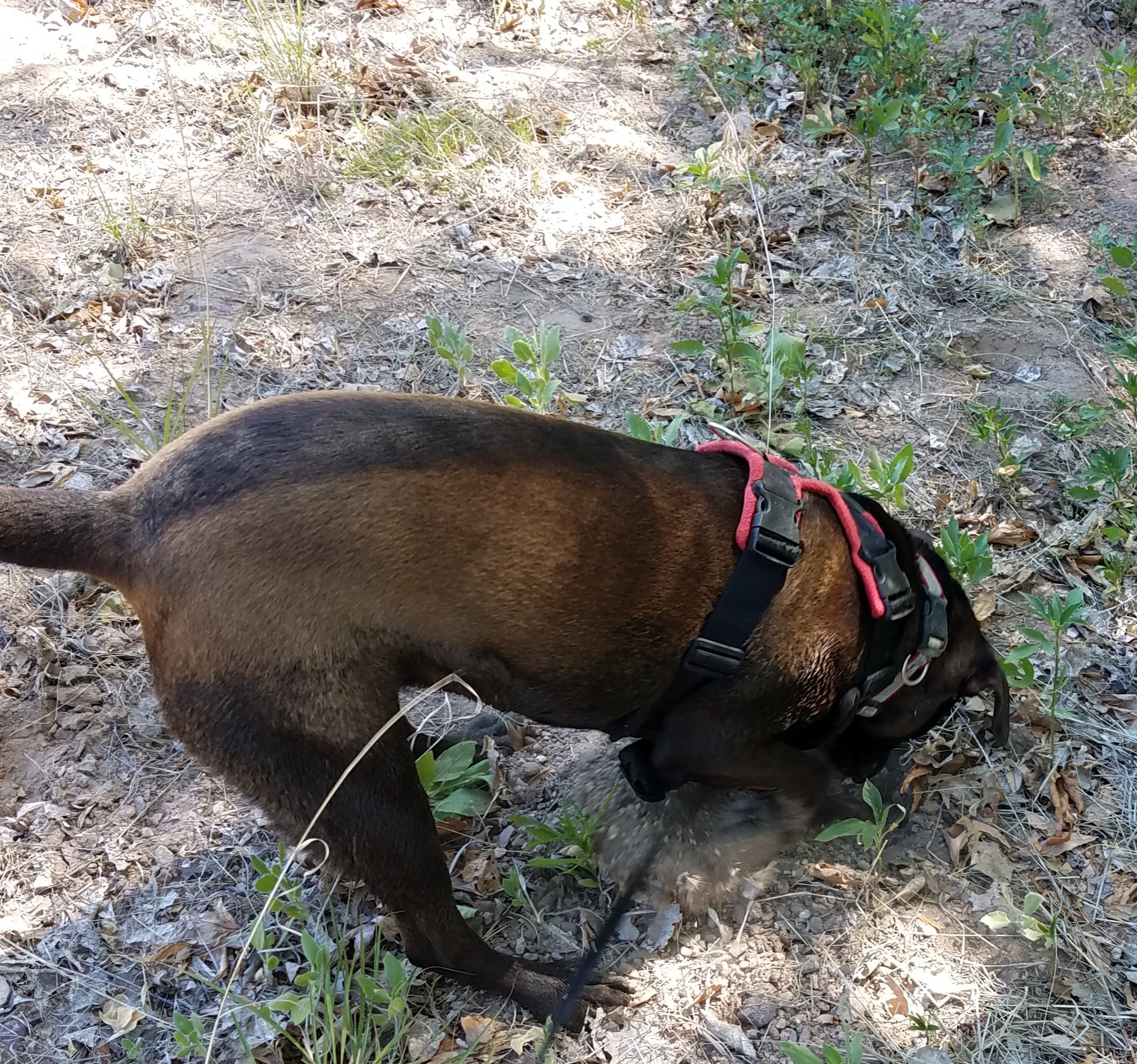
Dog has no such need, but goes because she loves the smells, the company and the opportunity to dig for a gopher or two.
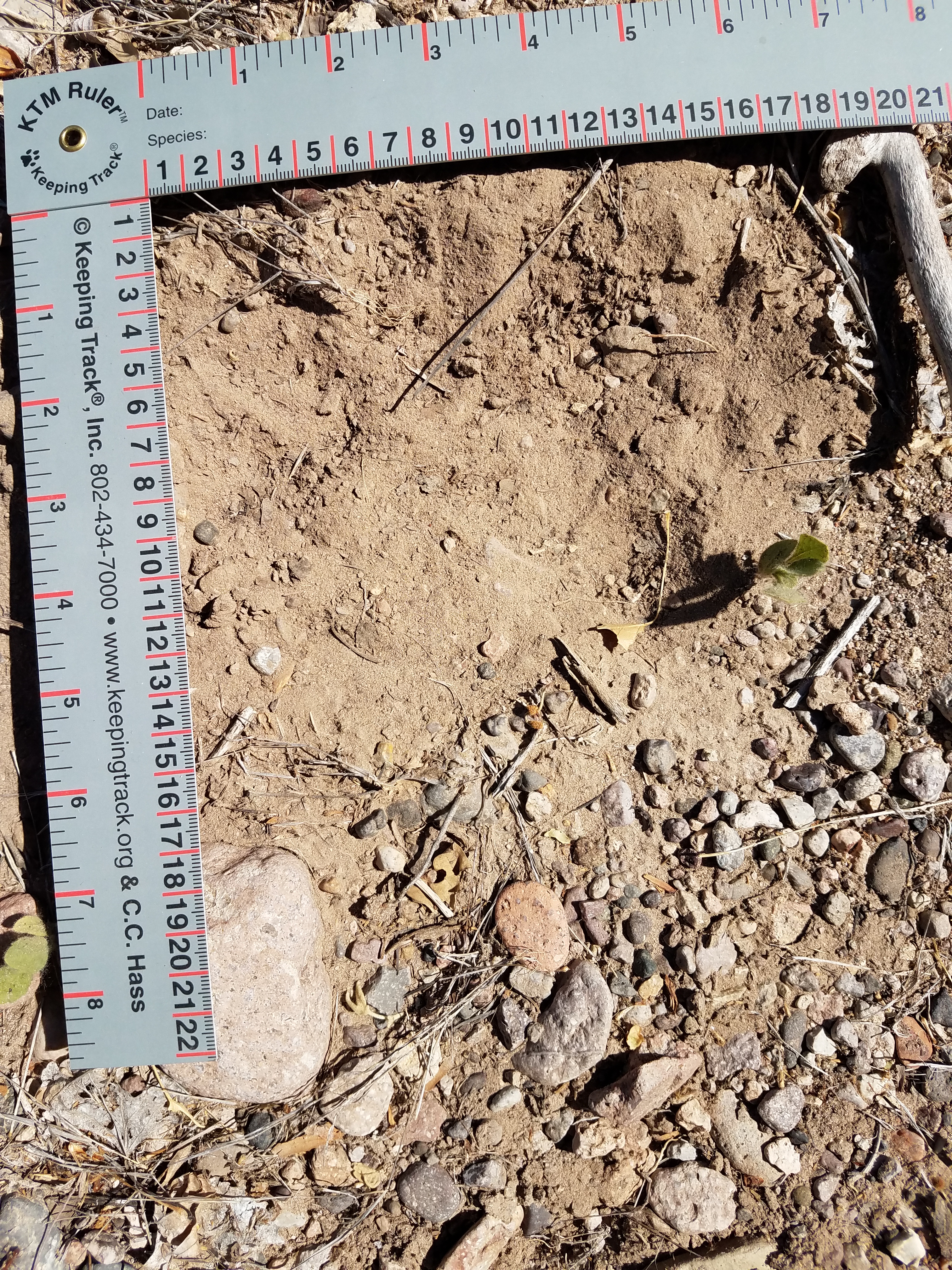
We carry books and rules and phones with cameras. When I remember it, I also carry a small reflector that can be used to direct more light into a track under examination. We walk looking down. We pause often and study the ground. We skim over grassy and debris-covered areas, preferring the silt, sand, mud fresh and hardened, even gravel and ant-hills. That’s where we have a chance of seeing tracks and sign. Although same would exist in the grass and among the fallen oak leaves and pine needles, it would take a tracker far more expert than us to notice, let alone identify tracks in that substrate. [Substrate: a fancy term for the ground we walk on.] We’re even known to get down on our hands and knees to blow debris out of a possible track or to sniff at possible sign for telltale marking odors. Believe it or not, dog is pretty patient, only straining slightly at the end of her lead. Her trade-off is that we are patient while she digs into gopher and mole holes and tunnels or slaps around in the river.
We’ve gotten pretty good at the big guys. Bear tracks, canine and big cat feet and scat: we see those pretty regularly and they are easier to identify. It’s the medium to smaller folks’ tracks and sign that resist for-certain identification. So we study and puzzle and flip through our books and open up our phone apps, measure and photograph and debate. To document a track or sign in our official transect, reported to Sky Island Alliance, we have to have a consensus of three. On our informal forays for our own benefit, we do the best we can. I have to say, we’re getting better.
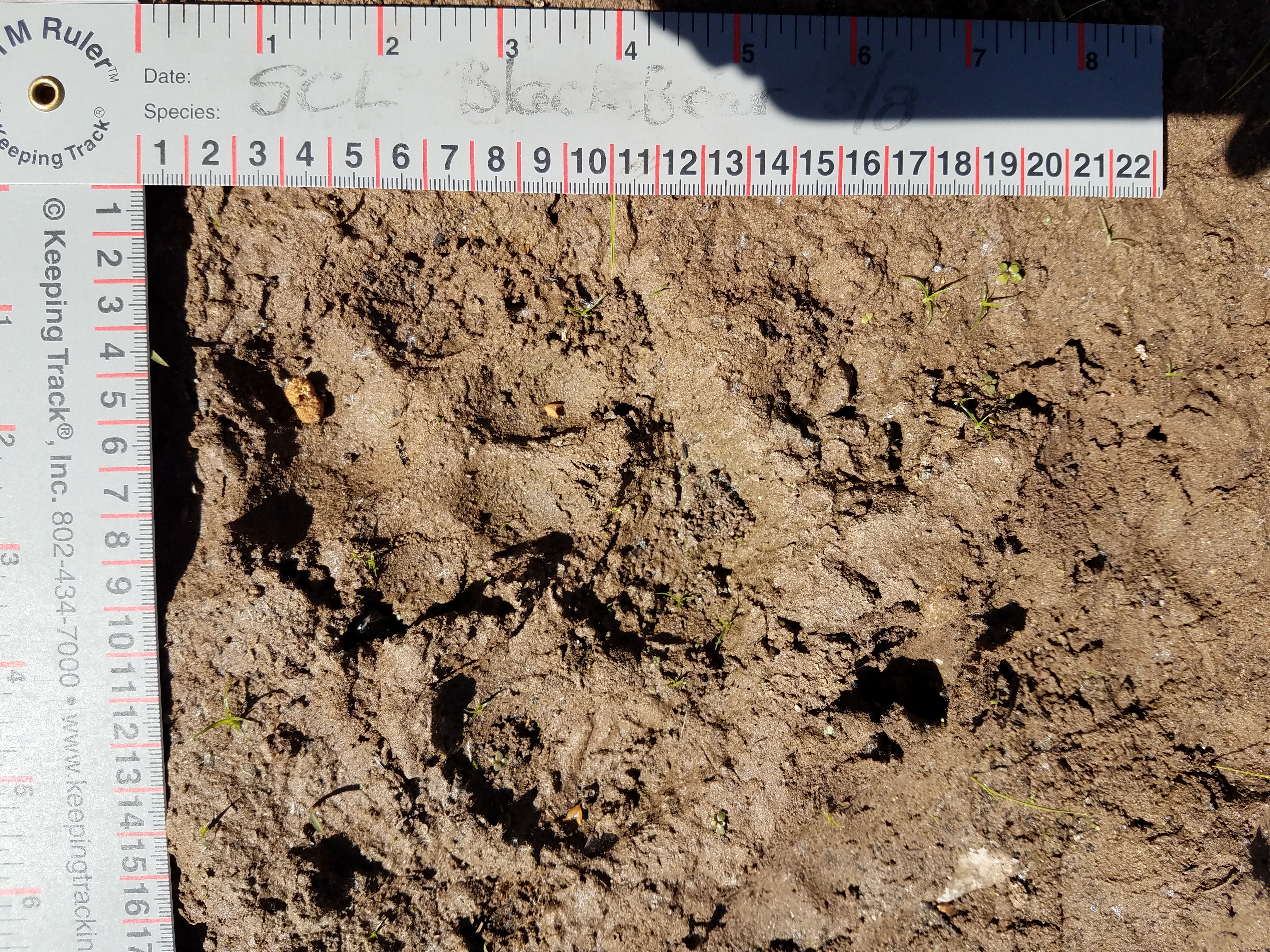
This outing netted us four tracks that we agreed upon. A black bear paced back and forth along the river bank. We found a relatively clear track for a front foot, and deep impressions where the bear stepped down a slight rise in the gravelly sand.
At another point along the river, we found a dance-party of mountain lion tracks: front and rear, going in multiple directions in a small area, as though the big cat was square dancing. Of course, there could have been more than one cat, but we couldn’t read that much in the mud. Unfortunately, the very best track, a large front foot, got overstepped by dog who came poking her nose in to see why we were all on our knees.
Our other two finds were a spotted skunk and after long debate, a white-nosed coatimundi. That last is still a bit up in the air, because the group of trackers to whom I submitted the picture of the coati track for confirmation were 2/3 in agreement and 1/3 of the opinion that the track belonged to a jackrabbit.
Spotted skunk
Coatimundi (or Jackrabbit?)
Oh, and this is the Important Bird Area and the trees were a glory of birdsong. We didn’t identify — or even really see one bird. I’ve learned you can’t look down and up at the same time!
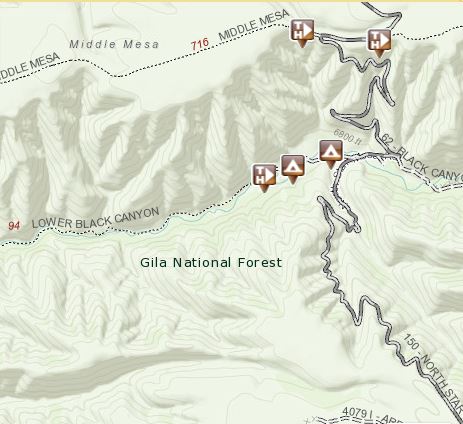
Black Canyon is carved east to west between the Aldo Leopold Wilderness and the Gila Wilderness. It connects the Black Range and the Mogollons in the Gila National Forest, a 3 million acre respite in southwestern NM. It’s remote, as any spot in the wilderness should be. There is one road, North Star Mesa Rd, that winds and twists and hiccups up the sides of ridges, runs along the tops of mesas and ridgelines, and slithers switchback down into a series of canyons. A high clearance vehicle is de rigueur; AAA isn’t about to come to the rescue of a low-slung sedan that scraped its oilpan loose on the rocks in the road. Washboarding is unavoidable because the road is too curvy to skateboard over the washboard ridges at speed. Since there’s no there, there, sliding across the black ice of washboard gravel can spin you out over the edge of the hill and down several hundred feet.
But it’s worth the trip. The campground is set along a perennial stream, shown on the Gila National Forest map without a name. At the entrance to the campground from North Star Mesa Rd, there’s a dam that plays a part in the project to reintroduce the native Gila Trout. Trail #94 starts at the lower end of the campground and follows the creek for a while, then peters out. Because it’s a challenge to reach, and the road isn’t one typically used to get from here to there, the campground is lightly used.
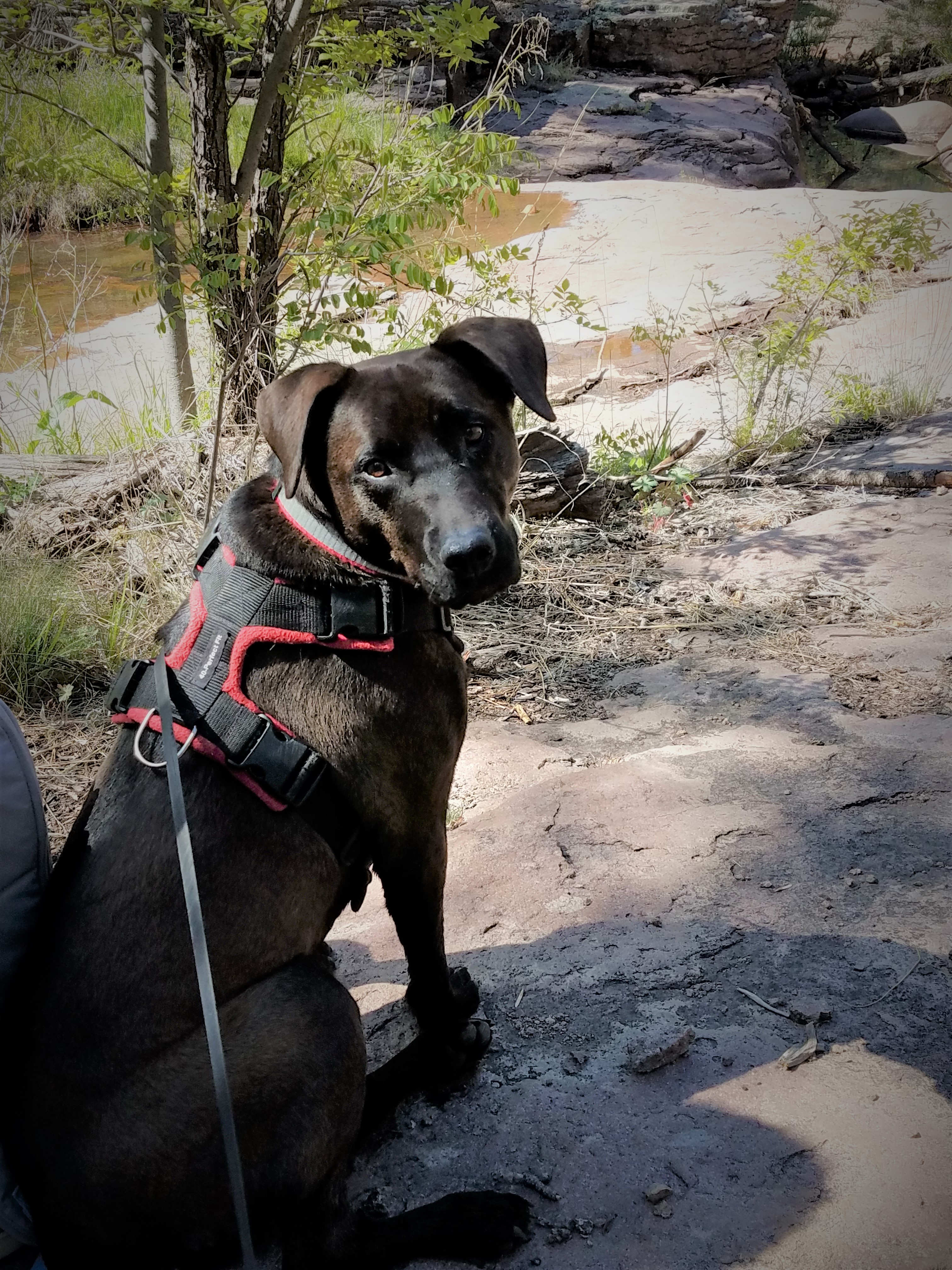
Our wilderness inventory tribe hasn’t camped together for a year or so, because our inventory work has finished and the results fed into the Gila’s forest planning process. It was time to get out and reconnect with each other and with wild places, to enjoy good food, good wine and lots of conversation. Our group went in for a two-night weekend. This time, I brought my dog. She’s a 4 year old 55 lb half chocolate Labrador Retriever and half Black Mouth Cur, more hunter than retriever and all muscle and curiosity. She’s an affectionate dog, a well-mannered dog. I can brag because I adopted her this way, and take no credit for her good behaviors. She’s never camped before and I wondered how she would fare in the woods with all those wild smells and sounds, and how she would sleep in a tent. I took her collapsible kennel and bed so she’d have something familiar come bedtime. When it was time, she didn’t hesitate to go into the tent, although the zipper door was a bit puzzling to her. Nor did she hesitate to curl into her kennel, take her bedtime treat and settle down. And I cozied into my sleeping bag and settled myself down. Until about midnight. I woke up reaching for my extra blanket, pulling it up over my sleeping bag. It occurred to me that if I was that cold, I wondered how the pup was doing, so I reached into the kennel to check. Sure enough, she was in a tight little ball, shivering. After trying unsuccessfully to cover her inside the kennel with a jacket, I gave up and invited her onto my cot and into my sleeping bag. A happy girl she was, snuggled up and hugged. It was about 34° when we woke up at dawn; no wonder we were both grateful for the other’s heat.
The next night, I borrowed a comforter from a friend who had the luxury of a camper. We thought, if we covered the dog’s kennel with the comforter, it would help keep her body heat in and ensure a warmer night in her own bed. That worked and we slept well until about 3 am. Once again awakened reaching for my blanket, I checked her in her kennel under the comforter, and once again, she was balled up and shivering. So, once again, invited into my sleeping bag and curled in my arms she was. At dawn, my fellow campers, bundled in puff jackets, hats, scarves and mittens against another 35° morning, greeted me over coffee, teasing about a 1-Dog night.
My dog and I took a bit of a walk on the dirt road that ran through the campground. On the top of a hill above the creek, we were attracted to movement in the creek below. She went on alert and I peered over the edge to see what had her so focused. A group of four or five mature javalina were working their way upstream. It became obvious that they were very aware of the dog. Still, they moved no more warily for her distant presence, but did keep one eye uphill. She was pointing with focus, but showing no intent to rush down the hill to confront the animals. Good thing. One dog and one or more javalina, and the javalina will always come out on top. They are non-threatening when left alone, but vicious if challenged. I had her on leash, but that would have mattered little if she really wanted to course downhill after the javalina; she could have pulled the leash right out of my hand and me onto my nose. We turned back to the road, only to confront a black bear coming down hill directly toward us. I saw the bear a split second before the dog did, and so was prepared if she decided to charge. Instead, she saw the bear and froze. That gave me time to call to her loudly and back us both up, away from the bear. Bear saw us, and, halting with a paw raised for a next step, studied us for seconds that seemed like minutes. I continued backing us slowly and talking, which gave the bear time to decide it didn’t really need to get down to the creek just at that moment, and to turn and lumber back up the hill.
I wonder if the dog will expect black bear encounters and sleeping bag snuggles on every camping trip from now on. Probably.
The recent rains made for expectations of good tracks on the river’s edges. We headed for the Gila River’s Bird Area, books and rulers tucked into backpacks. Along with us came the dog. I wasn’t certain whether one energetic dog would have the patience for three humans standing around staring at the ground for minutes at a time, but she did need the exercise.
The river was running really high and some of the edges were under water. There was one wash and several spits that were above the water line; they had been flushed by run-off and were rain-slick with mud. Since the light rain the previous evening, critters large and small had been dashing and dancing around, leaving a plethora of foot prints behind. The dog added tracks of her own, fortunately not overwriting the tracks we were most interested in deciphering.
Beaver tracks
Hog-nose Skunk
Stripped skunk
Raccoon
Beaver track and sandpiper track
Great Blue Heron
As a highlight, we found absolute evidence of the resurgence of beaver on this stretch of the Gila River. We’ve seen the beavers’ signature tree stumps, chewed to points. And there’s a beaver dam under construction just a mile or so downriver from where we were exploring. But here, we found tracks – impressed in the mud just since last night. Our “take” for the morning: beaver; two different skunk species—hog-nosed and striped; raccoon; great blue heron; spotted sandpiper; and squirrel. We might have found more, but for time and a dog’s tolerance. We documented and submitted all but the sandpiper and squirrel to iNaturalist to become part of the scientific database.
The only downside was when my backside went down into the mud.
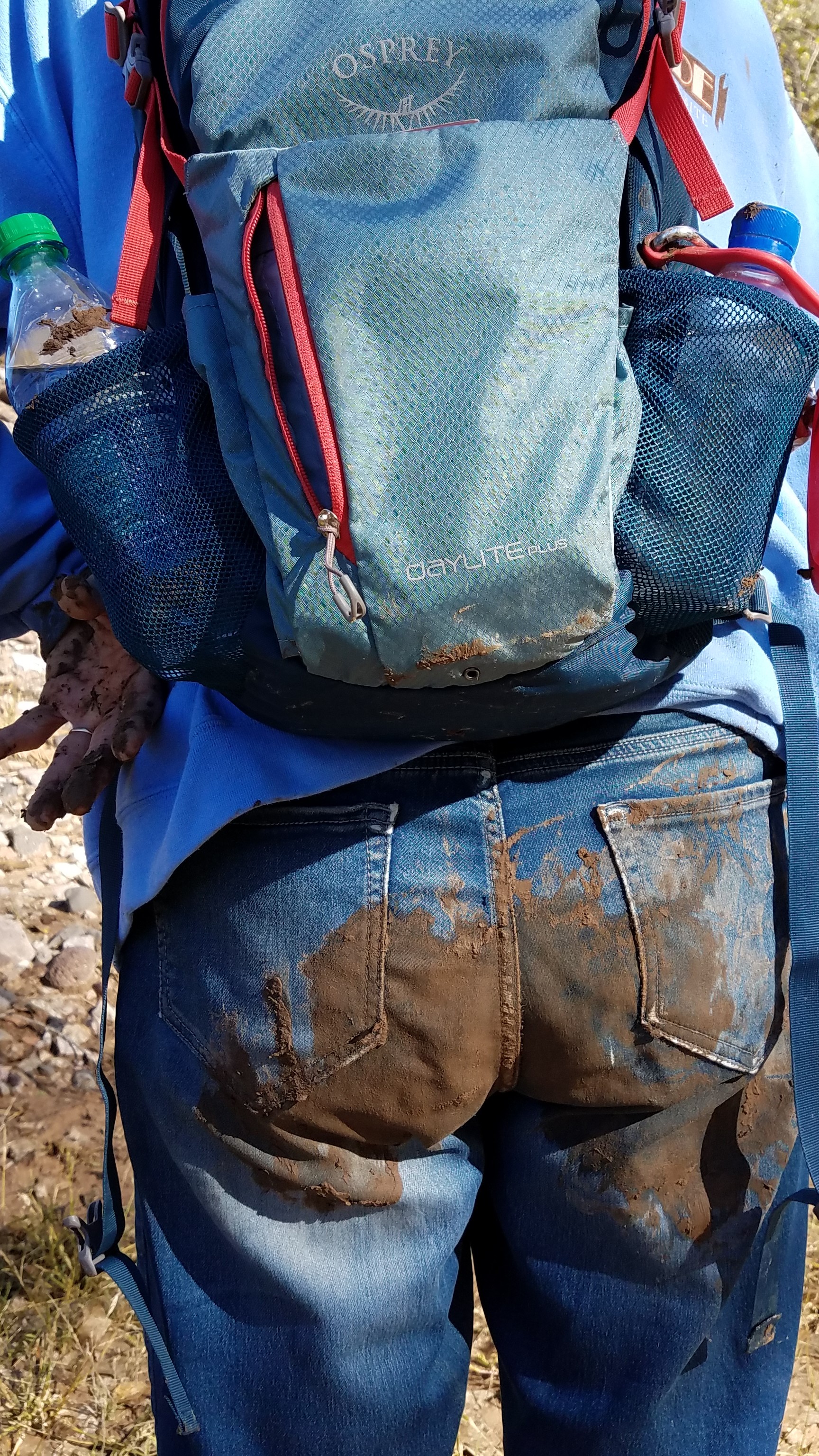
The next day took me in the opposite direction, down into the Chihuahuan Desert and in the shadow of Cookes Peak. We went to explore the remains of Ft Cummings, one of a string of forts originally built through the southwest along the Butterfield Stage line and set at critical water sources. These same forts were later instrumental in, first causing and as a result, defending against the Apaches in the 11-year Apache wars.
There’s not much left of Ft Cummings: a few bits of adobe wall; a cemetery hill whose occupants have since been moved; parts of the stone structure that was the stagecoach stop; and a springhouse that is not only still in use but has been brought into the 21st century by the addition of solar panels to pump out water for the cattle that are grazed on this piece of desert.
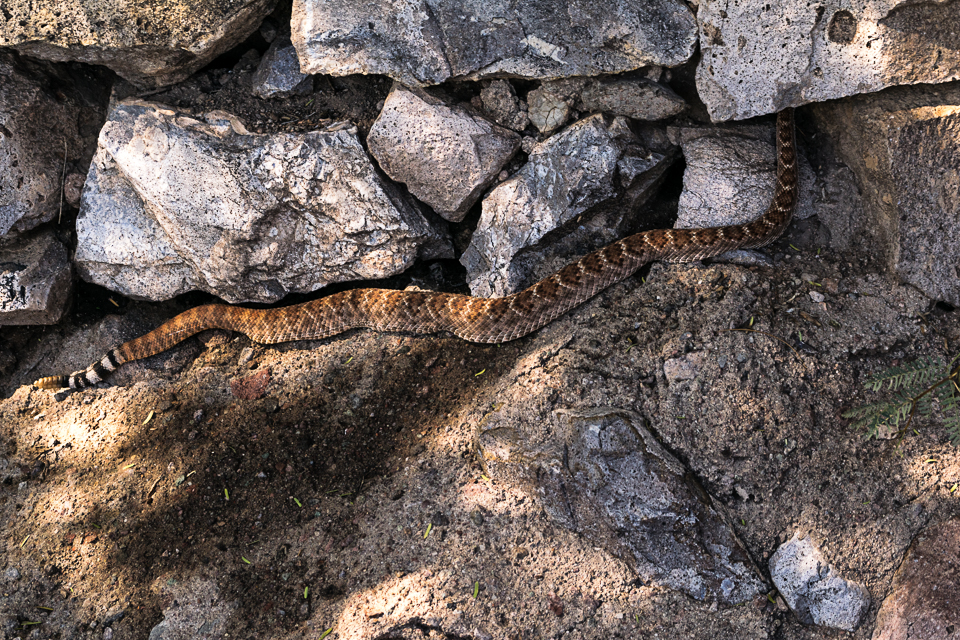
Stopped in the old corral area, where we thought to sit on the walls, water ourselves and have a bite of lunch. I wandered to the end of one wall to look for a seat in the shade under the only tree tall enough to cast any. There was already somebody stretched out. With due respect, I allowed as how he (or she) had first rights to the spot. Nonetheless, he (or she) decided to remove him (or her)self into hiding until we interlopers stopped staring, left the corral and a snake’s peace was restored.


 The Iron Bridge is on the old Rt 180, now in disuse except for swallows and hikers. It’s a beautiful old structure. The Gila runs under the bridge, along private ranch land and through property now owned by The Nature Conservancy. No official trails, but paths that are trod enough to keep the weeds down. It is getting warm, though and we are pretty exposed. We encounter a young man coming toward us as we stand uncertain, trying to discern where through the weeds we are meant to go. We head down the parting in the weeds that he just left.

")
 I got to Pancho Canyon thrice in a week, twice w Dog and once without her; all three times with one or two friends. Twice I spent my time looking mostly down and once, mostly up.
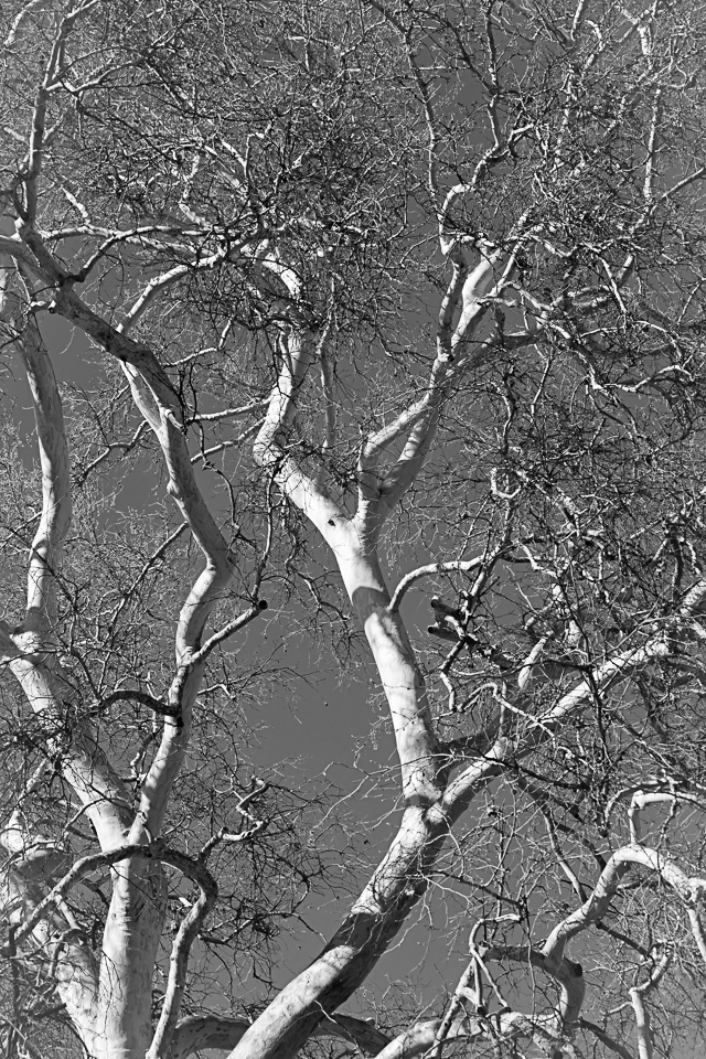


 Poppies. Mexican Poppies glowing along the roadside, in painterly splashes on the hillsides. And most spectacularly, spread across fields as quilts made of yellow, orange and gold, with love-knots of white. In New England, they go leaf-peeping in the fall. This week, I have indulged in Poppy-peeping.

 A black bear paced back and forth along the river bank. We found a relatively clear track for a front foot, and deep impressions where the bear stepped down a slight rise in the gravelly sand.